
Using drones to restore mangroves forests
Friday 26 July 2024
In Madagascar, our team and other partners have been aiding the Ministry of Environment in restoring mangroves forests by drone.
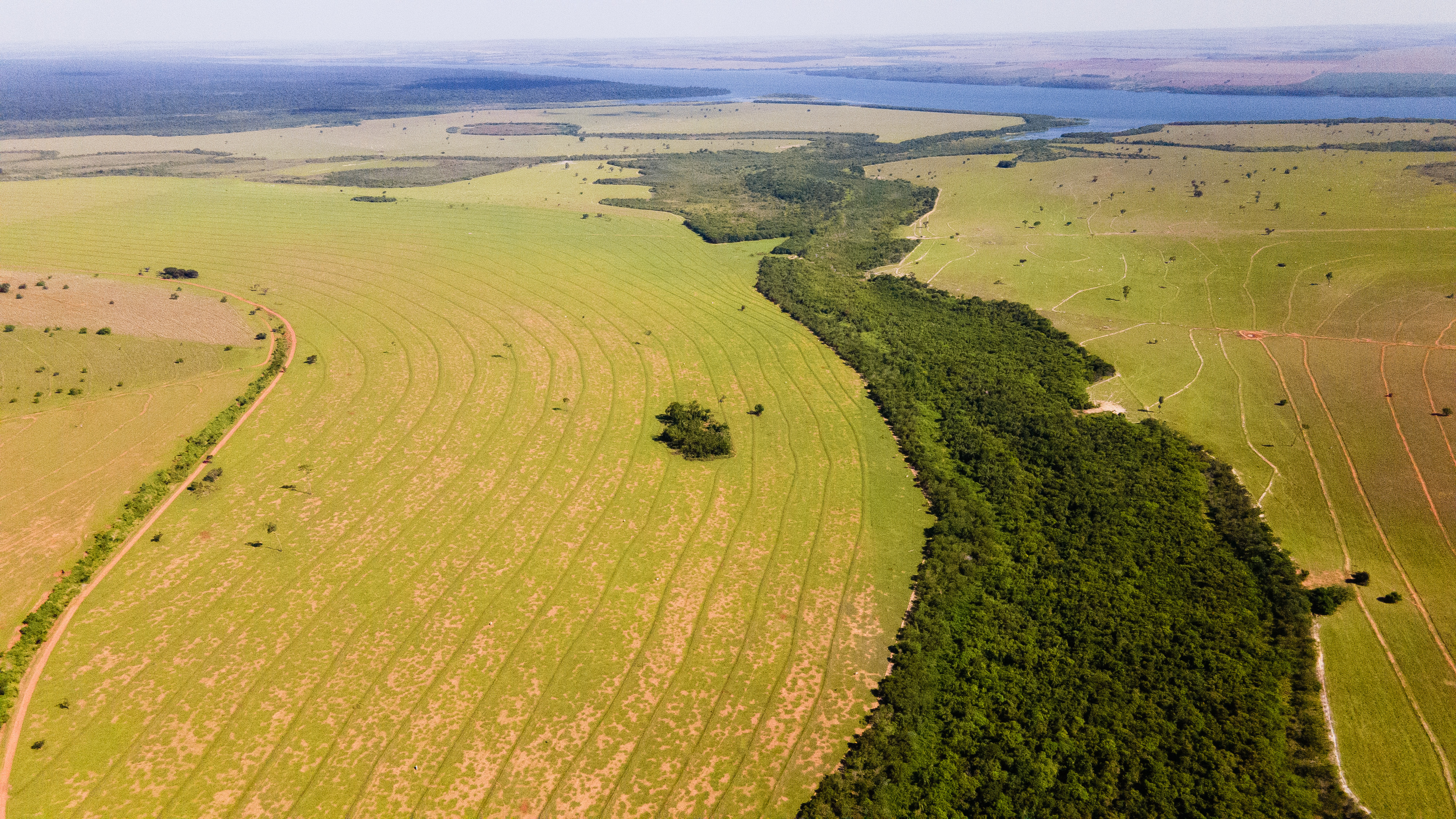
Found in tropical coastal areas, mangroves provide biodiverse ecosystems for wildlife and store the most carbon of all tropical forest types, as well as protecting coastlines from erosion.
Around two percent of the world’s mangroves are in Madagascar, where they are unfortunately threatened by deforestation for charcoal production and timber.
Durrell’s Drone Project Coordinator, Tsito Rakotozoely, has been assisting the Madagascar Government to build drones to plant mangroves. Funded by UK Research and Innovation’s Global Challenges Research Fund through Liverpool John Moores University, and now supported by a Darwin Initiative Innovation grant (UK DEFRA), these custom-built heavy-lifting drones are programmed to shoot seeds into the ground at defined heights and with specific distances between each seed.
This cutting-edge technology improves seed dispersal, covering more ground and enabling tree-planting in remote areas.

Tsito and his colleague Fy have now built four drones for the Madagascar Government, each with a 1.9m wingspan and capable of carrying 30kg of mangrove seeds during 20 minutes of flight time. In one flight, each drone can cover 1Ha and make three flights per day, depending on weather and site conditions. As well as building the drones, Tsito has been training the Ministry of Environment staff to fly them, which involves piloting the aerial drone from the ground by remote control.
Since 2021, the drones have planted mangroves across over 240Ha on both the east and west coasts of Madagascar. To track the progress of the seeds, local communities help monitor and survey the reforestation areas to ensure that the dispersed seeds grow correctly. Ministry staff will also use drones at three-month, six-month, and twelve-month intervals to fly above each restored site, scanning the landscape using photogrammetry, which provides a map to track landscape change and mangrove growth.
This year alone, Tsito has helped to train 80 new certified drone pilots, including staff from the Ministry of Environment, Madagascar’s Civil Aviation Authority, and other conservation partners. We will continue to train people around Madagascar to improve forest monitoring and surveillance, increasing capacity to use drones as an effective and efficient tool for biodiversity conservation and protection.
